Letter from Exmoor: A coastal walk from Combe Martin to Holdstone Down

Combe Martin to Holdstone Down

There is a concrete path running around the side of the bay at Combe Martin, and further along I can see a flight of steps leading upwards. I decide the steps must join the South West Coast Path, knowing it is somewhere on the slope above, and I set off.

On the way I pass a young boy who has been fishing in a rock pool. He has caught a large crab. He tells me it is only one of many – but the rest escaped.
steps to nowhere, Combe Martin, Ruth's coastal walkI climb the steep steps but find, to my surprise, the top section becomes progressively overgrown. I push through nettles and find the entrance to the steps has been blocked up with a wall of bricks. Why deny access? I can only think it is for ‘Health and ‘Safety’ reasons.

I climb over the wall and find myself in a pretty open space overlooking the bay, with a promenade and a gazebo.

Combe Martin, Ruth walking the South West Coast Path
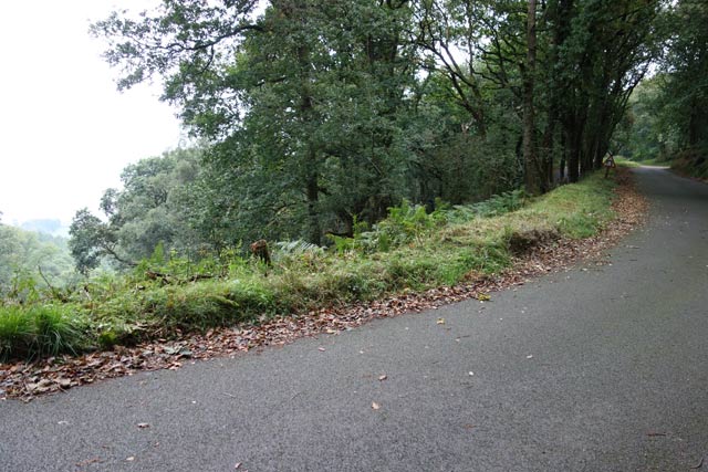
(In the photo above, the blocked entrance to the steps is hidden at the far end of the row of flowering bushes.)

The South West Coast Path takes a steep route up the slope on the east side of Combe Martin Bay. There are steps to climb and in places the path is narrow with overhanging brambles. I am relieved when I emerge from the undergrowth and see a sign: National Trust, Little Hangman. Wow. That was quick. I’m there already!

b03 path up steps, Ruth walking the South West Coast Path, Hangman overgrown SWCP, Lester Cliff, Ruth in Combe Martinb05 Little Hangman, Ruth walking SWCP, Combe Martin, Devon

I stop to admire the view of Combe Martin below me. Contained within the narrow valley, Combe Martin boasts it has the longest village high street in England. [Later, thanks toWikipedia, I am disappointed to discover this is an exaggeration!]
 view over Combe Martin, Ruth walking the SWCP, Devon

And now for another disappointment.

 view across Wild Pear Beach to Little Hangman, Ruth LivingstoneI consult my OS map and discover I am not at the top of Little Hangman after all.

My climb has brought me up Lester Cliff. Ahead and below is the deliciously named Wild Pear Beach. The tall headland on the other side is the real Little Hangman.

[According to the official North Devon tourist site, Wild Pear Beach is often used as a nudist beach. Access to the beach is always difficult, but has been cut off completely by a recent landslip.]

I follow an easy track up to Little Hangman and climb to the top point (218m) to have a rest and take a photo. Ahead is Great Hangman, 100 metres higher at 318m, the tallest coastal cliff in England.
from Little Hangman to Great Hangman, Ruth's coastal walk, north Devon coast
The way up is surprisingly easy. The path is well-worn and, although the incline is fairly relentless, it is not particularly steep.
 easy slog up Great Hangman, Ruth's coastal walk around the UK
At the top there is a cairn of stones and a group of other walkers are standing on the summit, taking photographs of each other. They must have come up the other way and they look rather hot and tired.

other hikers, top of Hangman, Ruth walking on the SWCP, DevonI congratulate myself on my cool appearance, and wait for them to move on.
b11 self-portrait gone wrong, Ruth on top of HangmanRuth Livingstone - self portrait second attempt, Ruth Livingstone on top of HangmanWhen they’re gone, I set up my camera for a self portrait, balancing it on a nearby rock, and run back to clamber up the cairn. Unfortunately my first attempt was not very successful.

I adjust the camera and try again. Success!

Greater Hangman – thehighest point on the South West Coast Path. Or is it…

Although I know, Greater Hangman is the highest coastal cliff in mainland Britain, it doesn’t feel particularly exciting to be standing on the top. One reason is that the cliff slopes gradually, and so there is no sensation of standing on the edge of something and looking down at the sea far below. So, it turns out to be a strange anti-climax, in a way.

There is a higher hill ahead. The other walkers pointed it out. (You can tell it is higher because its summit is above the horizon.) I check my map. Holdstone Hill and 349m above sea level.

looking ahead to Holdstone Hill, Ruth's coastal walking, North Devon

The route up Holdstone Hill looks clear and easy. It may not be on the official coastal path, but I decide to climb it anyway.  Full of confidence, and with 90 minutes before my planned rendezvous with my hubby at a car park somewhere on the other side of Holdstone Down, I set off.

But, I had conveniently chosen to ignore the warning contours on my map. Between me and Holdstone lies a steep cleft. Sherrycombe.
Sherrycombe ahead, Ruth walking near Combe Martin, Devon, SWCP
No wonder the other walkers looked exhausted. The path descends very steeply and I slither and slide my way down into the valley. To make matters worse, the valley is full of flies. They buzz and whine around my face. Are they midges? Or biting flies? I don’t know, but they are very irritating. I swat them with my poles. At least they keep me moving.

The only time I stop is for a quick photo of the bridge across the stream at the bottom. I stand still for less than five seconds and the buzzing is almost unbearable.
valley of the flies, Ruth in Sherrycombe, north Devon
In my mind, Sherrycombe will always be known as the Valley of the Flies.

It is only because I slow down during my scramble up the other side that I realise there is another reason for the buzzing in my ears. Somewhere a farmer appears to be trying to get his tractor out of a ditch, and somebody else is hurtling around the field on a quad bike. I catch little glimpses of this drama as I puff and pant my way out of the valley.

On the higher slopes of Holdstone Hill, I was hoping the breeze from the sea would blow the flies away, but the air is very still and it is some time before I lose the last of the pesky things. Now the path flattens as it circles around the shoulder of the hill.
on Holdstone Down, Ruth walking near Combe Martin, SWCP

I forget my plans to walk up to the top of Holdstone and ignore the footpath that points up to the summit. Too tired for further climbing.

A rustling and crashing sound from the bracken causes me some alarm. But it is only a stray sheep. It looks startled to see me.
sheep in bracken, Ruth on Holdstone Down, SWCP
The remainder of the walk is straightforward and easy, if a bit monotonous. The stony track hurts my feet. I head for the only buildings in sight on the horizon. The road must be up there.
final slog, Holdstone Down, Ruth Livingstone on SWCP
I find the car park rendezvous and, out of four possible options, my husband has managed to pick the right one! He greets me with drinks and fruit, and “what took you so long?”. The view, in the mellow light of the evening sun, is truly lovely.
view from the car park, Ruth's hubby on the SWCP


Tim

Miles walked today = 10
Total since beginning = 1,420 miles

Route:

Letter from Exmoor: Green and Pleasant Land Meets the Sea

By Keith Hunt. Originally posted on Keith Hunt’s blog on 7 July 2014

2010-02-11 01.49.22

On Sunday, the weather was perfect for a walk to Lynmouth and back again. With just two weeks until I take part in the Race to the Stones 100k this was my last chance to go for a long walk in preparation for it.

Once I had taken James to Bishops Lydeard for his day helping on the West Somerset Railway for their Thomas the Tank Engine weekend (another one next weekend if you missed it!) and Poppy to work in Minehead, I headed to Porlock for a day’s walking. I ended up parking the car near West Porlock and walked down to Porlock Weir. Back at home, there were some clouds about but here, the skies were blue and the views were really clear with the sun getting quite hot by now at 10.45 as I set off. It was still quiet with just a few visitors and the Ship Inn getting ready for a busy day on their festival weekend – The Weirfest. It was nearly high tide with a few boats bobbing on the calm water.

The coastpath is accessed from behind the Anchor Hotel or alternatively up some steps past the local businesses. The path runs alongside a couple of fields until it joins a small road which you walk along until reaching the Worthy Road Toll Lodge. To the right is an arched gateway to walk through before the path climbs up and through some unusual archways which I read were the creation of Lord Lovelace after spending some time in Italy. The path zig-zags up for a while including diversions after landslips in recent years. The path continues though woodland where dappled sunlight, birds singing and small streams  trickling down to the sea below make this an idyllic walk. After 2 miles, I arrived at Culbone settlement – a few cottages and England’s smallest parish church.

From here, there are a choice of two paths of which I took the lower path through Culbone Woods and the combes towards the Glenthorne Estate. At this point, you can walk down to the beach through an impressive Pinetum with it’s giant Redwood trees. Tucked away is also an old victorian Ice House. Continuing my walk, the coast path passes Sister’s Fountain, a natural spring below a man-made cairn and a large slate cross. The path then rises and meets a track going through a pair of stone pillars with a boar’s head on each one before passing a pretty victorian woodland lodge. Further along the track, the path leads off to the left along Glenthorne Cliffs and the first views of Foreland Point and looking back, views to Hurlestone Point as well as clear views across the Bristol Channel to Wales.

Once the path joins the road at Foreland, you can take the coast path or like me, walk down the access road to the lighthouse and taking great care, walk along the scree path around the point to rejoin the coast path at Countisbury where the cliffs are the highest in England. From here, you can see straight ahead to Lynmouth and Lynton as you walk down the hill, making sure you take time to enjoy the views in all directions. I arrived in Lynmouth at 2:45 so just 4 hours walking from Porlock Weir although I did walk at a fairly brisk pace. I would recommend this walk to anyone who enjoys walking as it is not that hard going. Allow around six hours to give yourself time to rest and enjoy the views and the peacefulness of the surroundings. The coastal 300 bus service is available to take you back to Porlock and Minehead. The last one leaves Lynmouth at around 5pm but check times online.

At Lynmouth, I had my packed lunch followed by a Styles ice cream before my return walk heading back up Countisbury Hill to the Blue Ball and a little further before turning right, down into the Doone Valley to walk through Brendon, Malmesmead, Oare and Robbers Bridge where it was time to take my boots off for a while and let my feet recover before heading back up the hill to the A39 where I crossed to walk from a path at the top of the main toll road down through woodland to Porlock Weir. As I reached the Worthy toll road, there were signs informing no walkers or cyclists were permitted and alternative paths should be used. I will enquire as to why that is as that seems a very strange rule. If I had my bike, I would not have wanted to take that anong the very rough path and would probably damage it by doing so. Hopefully, there are signs informing cyclists before they take the long descent. As I arrived back at Porlock Weir, the Weirfest was in full swing with live music playing to a large gathering. After my long walk, I was looking forward to getting home and a relax in the bath! An excellent day’s walking though a few miles short of what I planned.

Here are my Fitbit results: 53,557 steps. 25.85 miles. 4,680ft  ascent. 475 active minutes. 6315 calories burne

Book review – Joe and the Race to Rescue

Adventures in reading, running and working from home

Book cover - Victoria Eveleigh - Joe and the Race to Rescue This is the third (and final?) instalment in the Joe … series by Victoria Eveleigh (read my reviews of Joe and the Hidden Horseshoe and Joe and the Lightning Pony ). It picks up pretty well right after the last book, with Joe having moved on from his pony club champion, Lightning to new pony, Fortune. He begins to realise what a good teacher Lightning was as he struggles to forge a meaningful relationship with Fortune, who is of a very high quality but doesn’t seem to have engaged with him.

Meanwhile, Joe’s finally found a horsey world where girls, pink and sparkles do not rule: the world of the heavy horse. Introduced to Malcolm by Chris, the farrier, Joe’s soon learning all he can about driving and ploughing, taking out subscriptions and learning to care for – and even ride – these gentle giants. This is an area that…

View original post 239 more words

Letter from Exmoor: Lynmouth Storm – 2nd of November 2013

Text and photos by Amanda Perkins who published this on her blog “Amanda’s Adventures in Wool Land” in November 2013 

We live in Lynton which is half way up a hill,  at the bottom of the hill is Lynmouth, which is 2 minutes drive away.

About a week ago we had a severe weather warning for a massive Atlantic storm, the storm didn’t really happen here, although I know other parts of the country were badly affected.

But we had our storm on Saturday.

It was high tide at 5 pm, so Phil and I decided to venture out to buy fish and chips for our tea and see what the sea looked like.

We weren’t disappointed, as we drove down the hill the sea looked higher than the land, I have never seen it look so dramatic.

Stupidly we had left the camera in the office and so the following photo’s were taken with my iPhone.

The photos are dark, because it was getting dark

This is from outside the fish and chip shop looking west towards the Valley of the Rocks.

Lynmouth storm 21120131

This was taken from the same place, if you look carefully you can see a small black line, which was a surfer, there were several out surfing – Mentalists!!

Lynmouth storm 21120132

The harbour and the Rhenish tower, which shows how high the sea was.

The 2 Lyn rivers meet at Lynmouth, there is a small harbour with a wall that divides the harbour from the river, the tide was so high the wall had disappeared completely.

Lynmouth storm 211201313

We walked the dogs over the bridge to the other side of the river, this photo is taken east across the bay looking towards Countisbury hill, you can see a very windswept Phil and Loki, (there is a small black dot in the distance which is Tinks)

Lynmouth storm countisbury hillAnd another shot from the same place looking west, the boats you can see are inside the harbour, the harbour wall was under water. When we walked back over the bridge the water had flooded the road in front of the buildings and waves were crashing over the wall in all directions.

Lynmouth storm 211201314

The noise of the wind and water crashing twinned with twilight and the fact that the whole village had turned out to look at the sea made it a very surreal experience.

In a very strange way it was magical and I’m glad we braved the storm.


Letter from Exmoor: …some summer days I hide away and wait for rain to come……..

Text and photos by Gary Scarlett who first published this post on his blog “Chunky Mamil” on 17 November 2013

Sundays off are a rare treat for me so I grabbed the opportunity to get up early and hit the hills on the mtb. I didn’t feel like it at first though, tired after going back on shift my and head felt clogged up with stupid thoughts, the first hill of the day felt like hard work even more than usual.

I persevered though, the weather was cold, still and grey my kind of weather, the cloud just sits on the hills and you can get lost in the mist. Went down some new tracks and up some tracks I usually go down you get the idea, even though the legs felt like lead I still rode up them.

There’s a little track someone has made out in the forest so I headed down that towards home. So quiet and peaceful in the trees not a sound even the squirrels must have been having a lie in. It was so quiet I wish I could capture the moment or portray it better, it was a good place to be……..

Letter from Exmoor: Exmoor’s Forgotten Neighbour

Reblogged. Posted on by John Shortland on November 20, 2013 on his blog  

Sandwiched between barren Exmoor to the west and the rugged Quantocks to their east, the Brendon Hills appear remarkably fertile with their neat, small fields testament to a rich farming tradition. Now incorporated into the Exmoor National Park it seems to be as devoid of human life as it’s more visited partner.  It has, however, a surprising past: travel back in time one hundred and fifty years and you would find yourself in a thriving community at the forefront of Industrial Revolution technology.

A corner of the ruined building

For years, I had been intrigued by a ruined building close to one of the few roads that leads onto Exmoor proper.  Obviously once substantial, what could this building, miles from anywhere, have been and who lived there? There were no clues as I first approached but the  ruins, now stabilised, have had information boards giving its history placed within.  It was the site of an extraordinary Victorian venture that extracted iron ore and then transported it to the coast to ship to Wales for the steel industry.  Although, there was now just this one ruined building, in its heyday over two hundred miners and their families lived close by in houses built especially for them.

 Click on the image to enlarge the poster

The explosion of railway building in the mid 1800′s had created a huge demand for – and, consequently, a shortage of – iron ore.  Mining had taken place in the region on a very small, localised scale for many centuries but the small quantities found had never been a commercial prospect.  With the rapid rise in price and with advances in extraction the Ebbw Vale Company – Welsh steel works – developed the mines. A major problem was how to transport the ore the eleven miles from the furthest mine to the coast from where it could be shipped across the sea to Wales.  The first six miles from the port of Watchet was straightforward enough, the final six miles along the top of the Brendons, although more costly, also did not create a major problem.  It was the mile that included the climb of a 1 in 4 hillside that proved to be a challenge and a costly one at that – over ten times the amount required for the same length elsewhere and over £2 million in today’s prices.  ‘The Incline’ was completed in 1861 and took just four years to build, rising almost 800 feet in just 0.6 of a mile.

The ruins of the winding house as seen from the top of the incline

Trucks of iron ore were lowered or raised down the incline on twin rails, their steam locomotives held in place by steel cables.  The huge drums that were required to do this were housed in the ‘winding house’ with the cables travelling through stone tunnels, now the silent home of bats.  The force of gravity brought empty trucks to the top in twelve minutes as the weight of the full ones descended.   At the top of the incline the trucks passed over the roof of the winding house.  Communications between the men at the top and bottom were by semaphore.

The winding house – the trains passed over its roof

The cable tunnels

The price of iron ore and the methods of extraction continued to change rapidly and the railway never made a profit, with the mines closing just eighteen years later.  Remarkably, the railway continued to carry passengers for a further five years seated on wooden planks bolted to the tops of the iron ore trucks.  It must have been an extraordinary experience to be hauled up the incline and travelling back down couldn’t have been for the faint-hearted!

The incline today belieing the industry and grit of the men that created it

An even more short-lived attempt to re-open the mine was thwarted by the outbreak of the Great War and in 1916 the sleepers and rails were requisitioned and the drums blown up, demolishing part of the winding house building.  A further attempt  to rebuild the winding house for agricultural use was abandoned during WWII and it was only with the help of a National Lottery grant that the buildings were recently stabilised and the incline cleared of scrub and restored.

Marker stone

For further information including many early photographs and drawings visit the West Somerset Mineral Railway website by clicking here.

Add to Technorati Favorites

Recipe: Naughty winter treats

Seriously simple stewed apples

Reblogged. Posted on November 17, 2013 by Sarah Howells  in her blog, The Gluten Free Blogger
Soft, sweet apples in a sticky, toffee-like sauce with creamy vanilla ice cream melting through – sound like heaven? Trust me, this warming dessert will leave you feeling content on even the coldest winter night. Smelling the cinnamon wafting through the house as Mum made a non-gluten-free apple tart earlier, I knew I had to make something equally delicious.

Apples to me are the epiphany of autumn, be it in a comforting apple crumble or a fancy upside down cake. I don’t really like eating apples just on their own but I love cooking with them. So if you fancy something a bit naughty to eat which is a bit like a giant hug in a bowl, give these seriously simple stewed apples a go.

Pure heaven in a bowl.

Seriously Simple Stewed Apples

(Serves two – or one very hungry person…)

  • 2 apples
  • 2 tbsp dark brown or demerara sugar
  • Enough cold water to just cover the apples
  • 1/2 tsp cinnamon
  1. Peel and core the apples and chop into bite-sized chunks
  2. Add to a pan, pour over the water and add the sugar and the cinnamon
  3. Bring to the boil
  4. Simmer for approximately 5 minutes
  5. Turn up the temperature so the mixture is boiling – keep on a high heat until the moisture boils down into a syrup
  6. Pour into a bowl, add a dollop or ice cream or clotted cream, and enjoy…

IMG_1632

IMG_1637

Letters from Exmoor: “Picture this. Webber’s wood, Arlington Court…”

Reblogged from Diary of an Internet Nobody, first published on 10 November 2013.

After the heavy rain of the last few days it was good to see the sun rise in a clear blue sky this morning, so Elaine and I decided to go for a stroll in the woodlands on the Arlington Court estate.

Located on the edge of Exmoor not far from Barnstaple, the sprawling estate has been owned by theChichester family for over 500 years, although the house has only stood in the grounds since 1823.

Instead of entering the National Trust-run property at the main entrance near the house however, we took the back way in via the gate that leads into the working forestry land on the lower end of the estate, the gateposts topped with the Chichester family emblem, a heron brandishing an eel.

image

From the gatehouse we made our way along the track that gives a great view over the Yeo river valley to the hills opposite – also owned by Arlington – where we have often spotted the resident herd of deer.
No deer today, but a noticeable change in the trees as autumn colours begin to show themselves.

image

image

image

All along the winding track there is evidence of forestry conservation in progress.

image

image

image

image

The most vivid autumn colours are provided by the rows of bright orange beech trees, especially when seen against the verdant green of the ferns and pines.

image

image

image

image

A giant chestnut and ancient oak trees add different shades to the landscape.

image

image

And on a smaller scale, the variety of alien looking fungus growing on fallen trunks and tree stumps is extraordinary, new forms and textures everywhere you look.

image

image

image

image

image

But the most obvious change in the landscape today was the level of the river and the intensity of the waterfalls that criss-cross the trail, the recent rainfall having turned some of these gently trickling streams into foaming torrents that rush down the steep sides of the valley through the woods.

image

image

The low stone bridge at the weir is almost overwhelmed by the height of the water, the arches (which I have walked through in the past) filled almost to the top…

image

.. and the sparsely wooded plain on the riverbank has the look of a primordial forest.

image

image

One of the newly expanded waterfalls which runs under the track after flowing down the rocky slope…

image

image

… had become so impressive that I climbed the slope above the track and filmed my walk back downstream.
(You may wish to lower the volume before playing the clip)

The age of this woodland is evident wherever you look, the rugged rocky skeleton sometimes visible just beneath the surface…

image

image

.. and some strange organic shapes too.

image

image

If you would like to visit Arlington Court and see what else this beautiful estate has to offer, then go to THIS LINK.

Reblogged: The Porlock Hill Climb

Porlock hill climb

by the winner of the race, Tevjan Pettinger.

This text was posted by  on SEPTEMBER 29, 2013 in HILL CLIMBS

Sunday 29th was a 4 mile hill climb up Porlock Toll Road, organised by Minehead CC. The road was closed to traffic and it was a really great event, enthusiastically promoted by Minehead CC with support from Porlock toll road and Porlock village. There was also a very generous prize list sponsored by (www.exmoorexplorer.com). – a big mountain bike race held each August.

porlock-bottom

Porlock hill climb Toll road to the right, A39 to the left.

Despite travelling around the country quite a bit, I rarely go further south west than Bristol. I’ve done very little riding around Somerset so it was a great opportunity to start riding some of the Exmoor climbs.

The village of Porlock is quite charming and for a hill climber, seems inundated with great hill climbs at every junction. (hill climbers heaven or hell, depending on your point of view!) The A39 main road climb out of Porlock features number 4, in Simon Warren’s 100 Greatest hill climbs. (rated 9/10) At 25%, it is reputably the steepest A road in the country. However, the race was to be held on the alternative climb – Porlock Toll Road. This is a fantastic climb – 4 miles of pretty constant 5-6%. The road surface is good; and it’s as close to riding an ‘Alpine’ style climb as you will get in the south of England.  On the lower slopes it is mostly in sheltered woods, though every now and then you can get a glimpse of the sea to your right.

view-of-sea

There are two 180 degree switch backs. It’s a great feeling when you’re climbing and can see the road down below you’ve just come up. Towards the top, the climb shallows out, and is a bit more exposed. I rode it once before the race started and liked it straight away.

switchback

Double switch back


Porlock Hill climb (toll road)

  • Distance – 4.1 miles
  • Avg Grade – 5.5%
  • Max gradient – 8%
  • Lowest Elev 160ft
  • Highest Elev – 1,360ft (414m)
  • Elevation gain (370 metres)


The race

I believe it is the first time that a race has been held on the whole climb, so it was hard to gauge how long it would take. I thought it would be a little like Snake Pass, just a bit longer. I started off reasonably hard. The hill is slightly steeper on the bottom. It is a good hill to get in a rhythm and I stayed in the saddle all the way to the top. The 180 degree switchbacks were interesting. I’m not used to racing on these kind of climbs. On one corner, I had to touch my brakes as I was running out of road. Towards the top, the trees disappeared, and fortunately a tailwind gave a little help to the finish. The gradient also became a bit shallower for the last mile. I finished in a time of 13.24 (just under 18mph) This was enough for first place, and I think I can claim a course record.

It was also nice to get quite a few cheers from a surprisingly large number of spectators and marshals by the side of the road.

Porlock Hill
After the race, I couldn’t resist having a go at the other Porlock hill climb. It’s been a light week of training and it’s not often you get a category two, 370 metre hill to have a go at. That’s a real brute. A wicked section of 25% at the bottom and then another couple of miles long slog to the top. I’m sure many were glad to be racing up the toll road!

After the race there was a prize ceremony with former world champion Wendy Houvenaghel giving out the prizes. The whole event was really good, you felt a lot of work and enthusiasm had gone into it from members of Minehead CC, and it was nice to see it pay off.

One nice touch, the village of Porlock were really keen to encourage the event, helping us to have good facilities and a local womens group did the refreshments.  I also received a homemade trophy by local schoolchildren. Very cool. Perhaps we can suggest something similar to the residents around Box Hill in Surrey.

Some photos of Event

james-dobbin

James Dobbin (Arctic Sram RT – National hill climb champion 2006, 2007


pjones

Paul Jones Bristol South CC

start

The start.

tejvan-start-action

Tejvan Pettinger at the start. What you might call hill climbers arms.


walcot

(a VC Walcott rider)

wendy-houvenghal

Wendy Houvenaghel (Bike Chain Ricci) World Champion Team Pursuit

aryavan

Aryavan Lanham, Sri Chinmoy CT

Porlock Hill

The start.

clothes

Fortunately, it was a warm day.

rollers

Using muesli bars to prop up rollers on the grass.

Porlock Hill

Village of Porlock.

View from the hill

180c

Porlock hill


top-exmor

Right on the top of Exmoor from A road climb.

Porlock Pedal

After the event, the road was kept closed to traffic to allow other people to have a go at climbing the hill with car free roads. Quite a few people took advantage.

porlock-pedal

porlock-pedal2

Nice views

pedal3


Results 2013

Results Porlock 2013

Partial Results click to enlarge

  1. Tejvan Pettinger Sri Chinmoy CT – 13.24
  2. William Harrison – Taw  Velo – 14.36
  3. Charles Coleman – VC Walcott – 14.36
  4. James Dobbin – Arctic SRAM – 14.43
  5. Tavis Walker – VC Walcott – 14.56
  6. Paul Jones – Bristol South  – 14.59
  7. James Coleman -VC Walcott – 15.02

Women

  1. Wendy Houvenaghel  – Bike Chain Ricci – 16.14
  2. Wiebke Rietz – 1st Chard Wheelers – 19.16
  3. Ayse Vahiboglu – Exeter Wheelers – 19.17

Junior

  1. Sean Henderson – North Devon Wheelers – -15.04

Thanks to Vilas for many photos. And again thanks to those who helped put on the race. Hopefully, the event will be held same date in 2014.


Letters from Exmoor: Ironman

Ironman 70.3

June 4, 2013 by  | 10 Comments

Jochen Langbein, of Taunton Athletic Club, a club which my daughter, Isla, belonged to, having read my post on Ironman, mentioned to me the fact that the very first Half Ironman, Ironman 70.3, was put on in the UK, at the Ironman Qualifier site on Exmoor at the incredibly beautiful Wimbleball Lake. So I thought I would write a post about it to celebrate this fantastic event and to suggest that you go and spectate – it is the most stunning location, and the next event there is Ironman 70.3 on 16th June….put it in your diary! 

images-4The very first 70.3 race to ever exist in the world was in the UK – the Ironman 70.3 at Wimbleball Lake on Exmoor. This event has now taken on an iconic status, as do all Ironmans, and fills to capacity every year.  Age Group athletes can qualify from this race for the Lake Las Vegas Ironman World Championships 70.3.

You can download a programme that will tell you everything you need to know, starting with the race day schedule. You will learn that Lake Wimbleball has been nominated to be the first Dark Skies Discovery Site on Exmoor and that Exmoor National Park has been designated an International Dark Sky Reserve, the first place in Europe to achieve this prestigious award. It’ll also tell you that a downside is that you shouldn’t expect to get a mobile signal here!

I learned that Nirvana Europe is  the Official IRONMAN Europe Travel Agent and that they have been moving UK athletes and their bikes to major triathlon and duathlon events, all over the world since 2002. In 2013 they will cater for the travel and accommodation requirements of almost 1,250 athletes travelling to IRONMAN and IRONMAN 70.3 events in Europe, Australia and North and South America. Nirvana are hot on logistics… they know the locations, know the people involved and put in place the most comprehensive race related logistics plan you could hope for if you wish to compete. I also learned you can book to have a pre- and post-race massage. That’s mandatory in my book!

The swim course is one lap, clockwise, starting 20m from the shore of the lake at 7.00 AM, and the second wave at 7.15. Swimming in the lake is forbidden at any other time. From the exit of the swim to transition is approximately 400m on grass. The IRONMAN 70.3 UK Exmoor bike course is a tough two lap course right in the heart of Exmoor National Park. The course leaves Wimbleball lake and follows an anti clockwise loop through hilly terrain in a particularly picturesque part of Somerset. It is 56.4 miles and 3904ft/1190m of climbing over the whole 2 lap course. The run at Wimbleball Lake is a three loop course on a mix of terrain including tarmac, hard pack trail and grass. 13.1 miles long there is 1323ft/405m of climbing over the whole 3 lap course. There is one short sharp climb in the course which is tackled three times, followed by a steep descent. There you are, Ironman 70.3 UK in a nutshell. Why not check it out for yourself? [http://www.ironmanuk.com/ ]

IM703_UK_2012_200


This post was originally published by Caro Ness on her blog