Date for the Diary: LIBERATOR – Dance Performances in and around Porlock Vale

MID-AFTERNOON.
OCTOBER 1942.
A PLANE CRASHES.
A SOLE SURVIVOR.

201 Stacked Wonky Poster

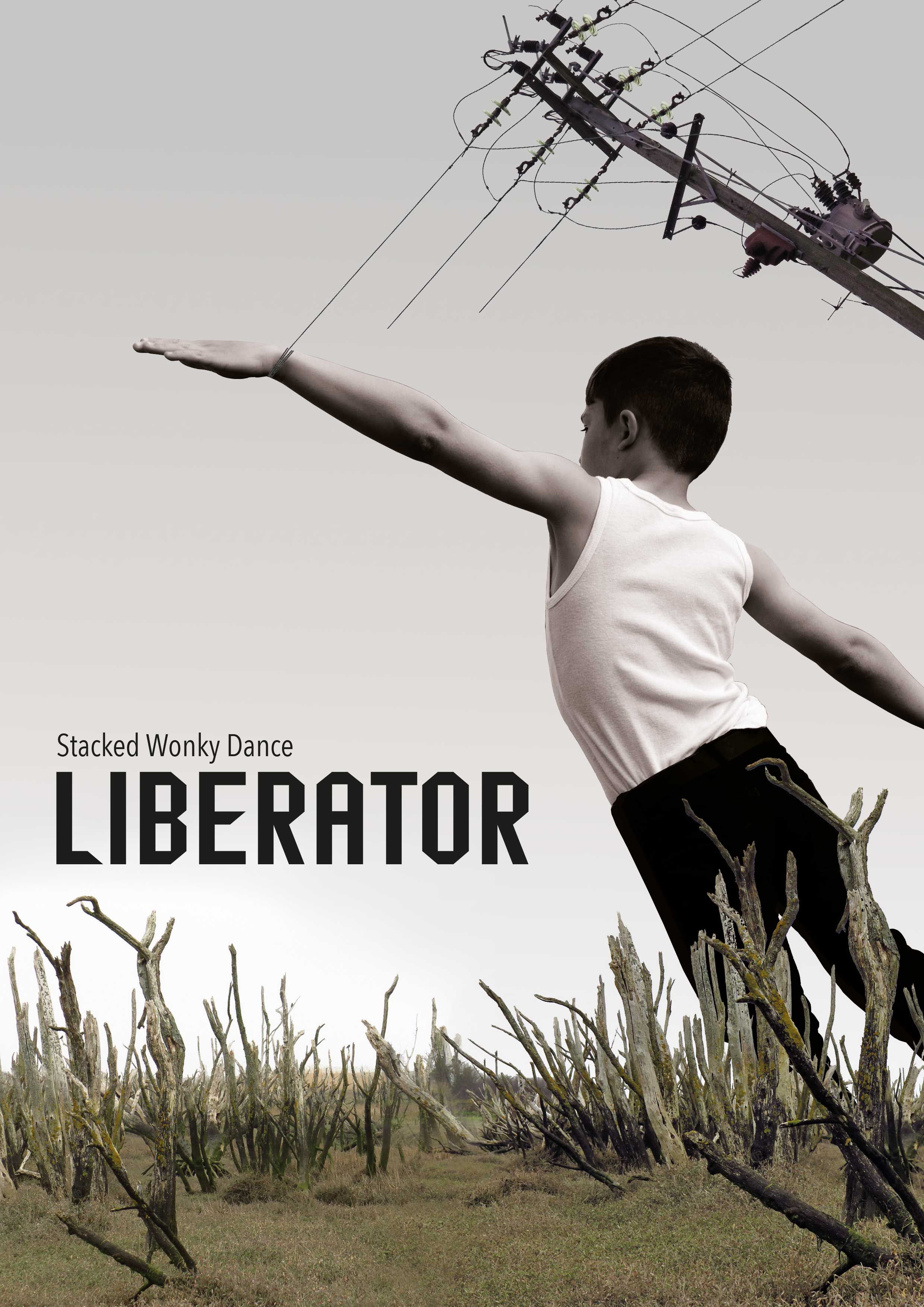
In collaboration with The Crown Estate, National Trust Holnicote Estate and Porlock Manor Estate, Stacked Wonky Dance has created five site specific dance encounters for five different sites in and around Porlock Vale.  The seed idea links to the crash of a Liberator, an American bomber, on Porlock Marsh in 1942 when 11 people lost their lives and one person, a staff sergeant, survived.

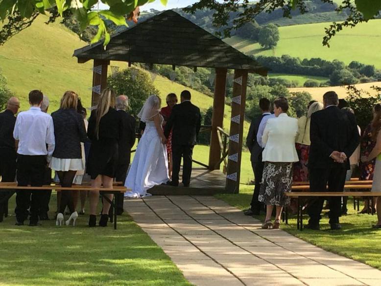
Performances will take place in a variety of spaces – glade, field, barn, hilltop and marsh – and will be seen at different times of day.  You can watch just one or all five as they unfold over the summer, culminating in a finale on Porlock Marsh on Friday 18 and Saturday 19 September.

As part of a small group, you’ll go on a walking journey, perhaps in daylight, perhaps at night, as the action plays out around you.  You’ll encounter a tilted, sometimes extraordinary world in which the unexpected often happens as movement, sound, shadow, weather and audience combine.  Don’t worry, you won’t be expected to do anything, certainly not dance (!), just follow the performance as it plays out.

Background

Two years ago, Sarah Shorten, Artistic Director of Stacked Wonky Dance moved to Bossington with her husband and young family.  During this time, Sarah inevitably turned her attention to the world just outside her back garden.  She was drawn to Porlock Marsh, which is how the idea for Liberator was born. After talking to local historians and residents, she gradually realised the crash’s recurring themes of loss, sacrifice, survival and childhood excitement about the war might be captured in a series of performances that return all fragments of the story to the Marsh.

202 Duncan Hume Wingspan by Rod HigginsonSarah has joined forces with Duncan Hume, an ex-Royal Ballet professional dancer living in Luxborough, and four children aged 5 to 8 from Timberscombe School.  All will perform in Liberator.  The project also involves a wide and eclectic team of local collaborators – including designers, costume makers, photographers, sound artists, National Trust rangers, foresters, tenants and technicians – without whom Liberator would not be possible.

Through Liberator, Sarah wants to show audiences what’s possible when dance heads away from the stage.  In addition, she is keen to continue to engage with those in local community for whom the Liberator crash and its legacy remain strong.

The Crash

Liberator has received invaluable support from Dennis Corner, a local historian and author of “Porlock in Those Days”, from which the following is taken:

“A long-range bomber, transport and reconnaissance aircraft, a Consolidated B-24 D Liberator with four 1,200 hp radial engines, a wingspan of 110 feet, a length of 67 feet 2 inches, a maximum speed of 300 mph at 30,000 feet and a range of 2,100 miles crashed on the marsh on 29th October 1942. It carried a crew of twelve and had ten .50 machine guns.

This particular plane, which was helping RAF Coastal Command, took off from Holmsley, South Hampshire at 7.20 am on 29th October to fly on anti-submarine patrol in the Bay of Biscay. When it was returning at about 3.30 pm it was seen by two boys, Alan Perkins and Brian Richards, to hit a point near the top of Bossington Hill and swing round. Pieces fell off: a wheel and part of the undercarriage landed at the bottom of Sparkhayes Lane, and the rest of the plane crashed on to the marsh. The weather was dreadful: it was a very wet day with low cloud all around.

Only one man, S/Sgt H.B. Thorpe, was still alive. Very little of the plane was seen by local people as its remains were salvaged within a few days.

A simple monument on Porlock Marsh was erected by members of the Porlock Branch of the British Legion, made from materials available at the time.”
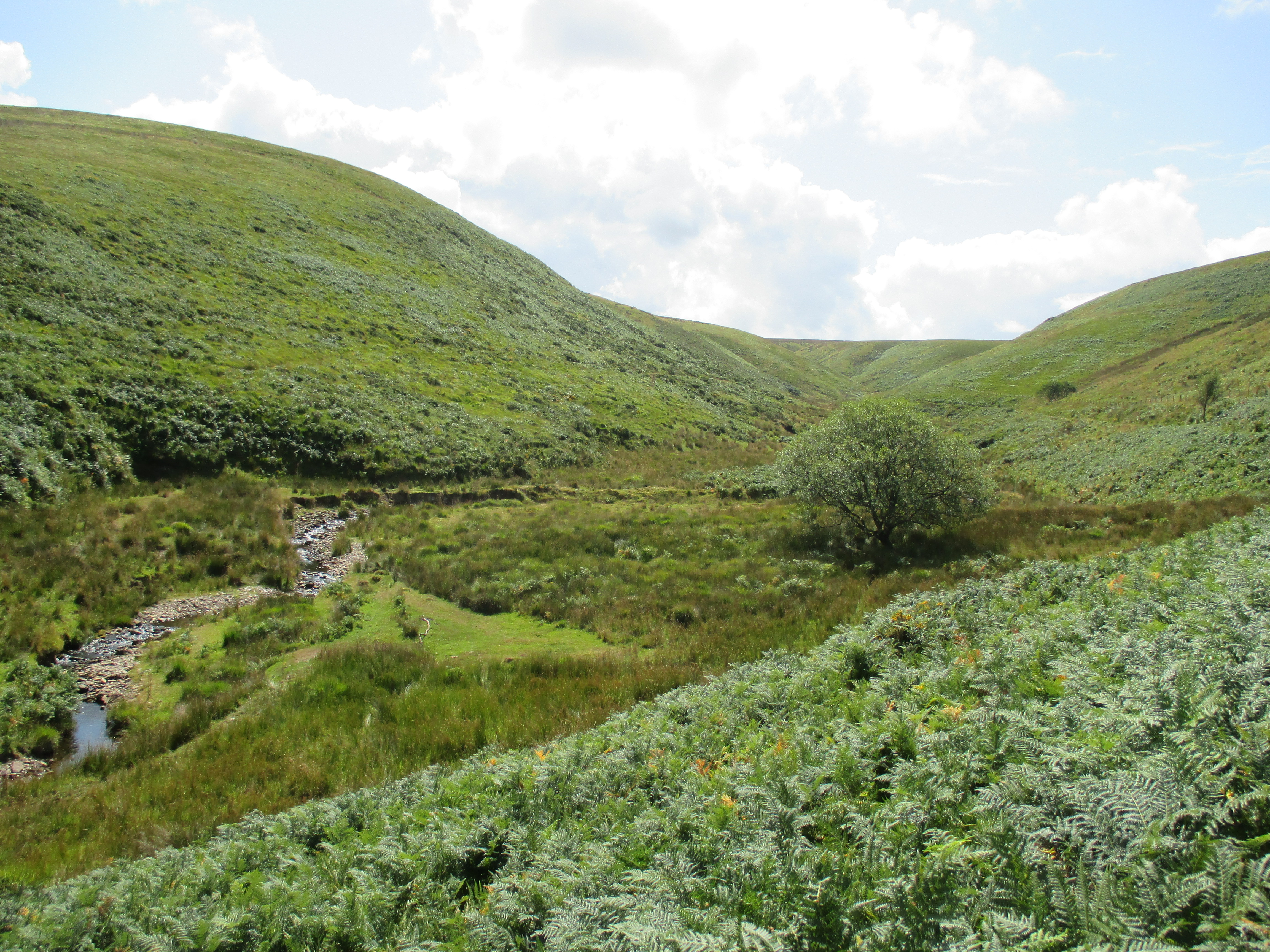
Porlock Marsh

BARN.jpg

Liberator has also received support from A Vision for Porlock Marsh, a project led by Porlock Parish Council, working with the local community, landowners and agencies, to help raise of awareness of Porlock Marsh and enhance its role as an asset for the local community, businesses and visitors, including encouraging events and activities inspired by the Marsh.

“A dynamic, constantly changing landscape of salt marsh, brackish water, grassy paths, crumbling stone walls and muddy ditches, tucked behind a massive sweeping shingle ridge.

Dead, stark trees, redundant fences, buried signs, freshly deposited shingle are clues to the rapidly changing state of Porlock Marsh, and for some enforce the sense of danger. For many local people the Marsh evokes happy memories – the Marsh before the breach; a time of picnics, play and haymaking. A landscape loved by generations.”
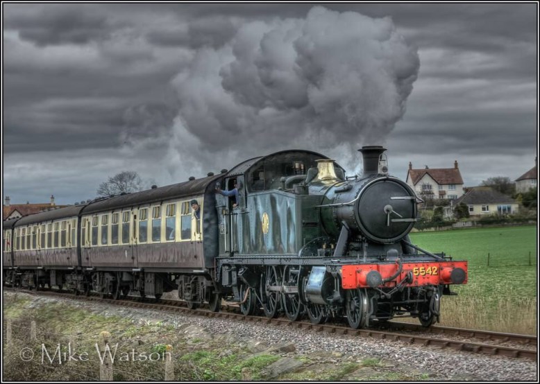
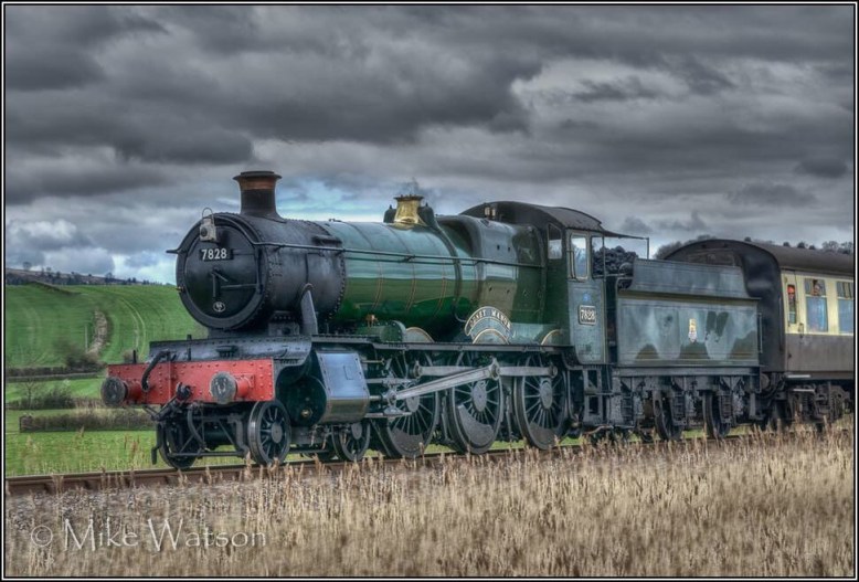
Stacked Wonky

Stacked Wonky is a contemporary dance company which has, for the last ten years, built its reputation on a desire to make work in unusual places for an audience unfamiliar with dance.

“Anarchic and exuberant, the movement she creates is beautiful” say Time Out

The company specialises in creating site-specific dance performances, many of which are performed in unique outdoor spaces and landscapes.

Sarah Shorten, Artistic Director, has created work for a diverse set of spaces including Trafalgar Square, The Museum of Childhood in collaboration with the V&A Museum, and Tinside Lido in Plymouth.  Her work has been supported by various organisations such as Arts Council England, Greenwich & Docklands International Festival and Dance South West.

Performances

Episode 1: GLADE

Saturday 25 and Sunday 26 July @ 4 pm
Nutcombe Bottom, Dunster

More info…

Episode 2: FIELD

Saturday 15 and Sunday 16 August @ 2 pm
West Luccombe Farm, West Luccombe

More info…

Episode 3: BARN

Thursday 20, Friday 21 and Saturday 22 August
@ 8.30 pm / 9 pm / 9.30 pm

SECRET LOCATION on the Holnicote Estate

More Info…

Episode 4: HILL

Sunday 6 September @ 11 am or 2 pm
Bossington Hill, near Minehead

More info…

Episode 5: MARSH

Friday 18 and Saturday 19 September @ 6 pm
Porlock Marsh, Porlock

More info…

For more info, please go to www.stackedwonky.com
Photos: Rod Higginson

Dates for the Diary: The Walking Book Club

Love walking, love reading?​ Then this could be the book club for you.

Our next walk is on Saturday 11th April and we are reading WAKE by ANNA HOPE. Copies available direct from Number Seven priced at £6.00 RRP £7.99. Joining the book club is free and we look forward to welcoming new members and meeting up with our regular two and four legged friends this year. Postage can be arranged if you would like to join us whilst on your holidays here on Exmoor – simply call the shop to make payment 01398 324457

This year we plan to meet every second Saturday of the Month – see dates below. Our May walk will be part of the 2015 North Devon & Exmoor Walking Festival and we shall be reading H IS FOR HAWK BY HELEN MACDONALD Copies available from Number Seven priced at £6.00 RRP £8.99

DATES FOR 2015: 11th  April, 9th May, 13th June, 11th July,

12th September, 10th October, 14th  November & 12th  December.

*Please note a level of walking fitness is required and walkers must be comfortable around dogs

*there will be no walk in August

For further information about upcoming book selections, please go to the website of Number Seven in Dulverton.

A busy day at West Somerset Railway


All photos by Mike Watson.

Snowdrop Valley 2015

Snowdrop Valley 2015 Exmoor

Open from Saturday 31st January
to Sunday 1st March inclusive

Snowdrop Valley is a privately owned remote valley in a hidden part of Exmoor close to Wheddon Cross

The Badgworthy Land Company kindly allow access to the valley while the beautiful carpet of snowdrops is in bloom throughout February each year

Cutcombe Parish Council, in conjunction with Exmoor National Park Authority runs a Park and Ride Service to Snowdrop Valley and staffs the Snowdrop Valley Information Point in the Car Park

Visitors can also walk down into the valley and there is a variety of merchandise available to purchase as souvenirs.

Buses will be operating to the valley from Saturday 7th to Sunday 22nd
February inclusive. The buses have disabled access
There will be walking access only when the buses are not operating
(31st Jan to 6th Feb and 23rd Feb to 1st March)
No vehicles will be allowed into the valley

Downloadable Snowdrop Valley Brochure for 2015

Visitors with mobility problems who cannot visit the Valley while the buses are
running should contact snowdropvalley@gmail.com to arrange a visit on the weekend of 31st Jan/1st Feb or 28th Feb/1st March to be issued with a mobility pass

Parking for all vehicles is at the Exmoor Farmers Market, which is also the start of the walks into Snowdrop Valley, and is clearly signposted from the village

Snowdrop Valley Information Leaflet 2014 ….click here to download

Walking route maps
Winter clothing and suitable sturdy walking footwear is essential. The walking routes take in bridleways and footpaths, and can be very muddy

Short WalksRouteMap
Medium WalkRouteMap
Long WalkRouteMap

Snowdrop Valley Merchandise Please click here to view

The single track lane into the valley is closed by a legal road closure order throughout February. Any vehicle entering the valley without an authorised Vehicle Pass will be reported to the police.

(via www.wheddoncross.org.uk)

A Wedding with a View

501 Little Quarme wedding


502 Little Quarme Wedding


If you would like to get married on Exmoor and enjoy this magnificient view with your guests, then please contact Little Quarme Cottages.

Date for the Diary: Walk Some Moor, 31 August 2014

64

?????“WALK SOME MOOR!”

A sponsored one day walk across Exmoor in support of Muscular Dystrophy Campaign

(www.muscular-dystrophy.org) starting at Lynton and The Cleaves, taking in the spectacular views on Cheriton Ridge, across rugged moorland to Exe Head and Badgworthy, passing famous landmarks – Cloud Farm, Lorna Doone Farm and finally through the wooded valley via Watersmeet back to Lynmouth and Lynton.

Date

Sunday 31st August  2014 @ 9am

Lynton Bottom Meadow Car Park, Castle Hill.  Own transport to be arranged.

Walkers

Please ensure you have plenty of water and food, comfortable walking boots and waterproofs (OS Map 180 1:50,000 recommended).  The walk can be joined either at the start or at the following points: Hillsford Bridge, Brendon Two Gates.

Further Details

For further information, sponsor forms (and FREE T shirts – optional) via Laura Crouch,

Volunteer Fundraising Manager for the South West and South Wales,

Mobile: 07771 374836;

Email: l.crouch@muscular-dystrophy.com

To donate directly:

Muscular Dystrophy Campaign

(Quote: ‘Exmoor Walk’)

HSBC Bank Plc.

Sort Code: 40-06-21

Account Number: 42287129

“Walk the Moor!”- Directions

1.Lynton – The Cleaves

(Stunning vistas and woodland)

From Lynton Bottom Meadow Car Park, turn right and walk down the hill.  Cross over the road (Lynmouth Hill) that heads down to Lynmouth and continue along the road until you reach The Cottage Inn pub. 

There is a footbridge to the right of the pub.  Cross the footbridge and turn left.  Climb The Cleaves (the path through the woods), taking the top right path at all times, following signs to Hillsford Bridge.  The path will end at a winding road (Watersmeet Road). Walk down the road to the junction – Hillsford Bridge.

2.Hillsford Bridge – Blackpitts Gate

(Woodland, 360 degree views of open moorland)

At the junction, turn right at the sign ‘Bridge Ball, Cheriton, Scoresdown’ and head towards Combe Park.  Turn right at the sign for Cheriton Ridge before the house that takes you through woodland.  Keep on the path following signs to Cheriton Ridge (the lower path) until it ends at Smallcombe Bridge and the farmhouse on your left.  Turn left and then right up an uneven path behind the farmhouse – this is Shortacombe Common.  Keep left until you arrive at Scoresdown Farm, the start of Cheriton Ridge.

Turn right into a lane next to the farm which reaches a 3 way junction.  Take the middle track onto Cheriton Ridge. Stick to a straight line as this track will take you to a ford and a gate at Hoar Oak Tree. Cross the ford and pass through the gate and take a left turn until you reach another gate.  Pass through the gate and continue along the track. Keep going and continue on the path to Exe Head (signposted with a gate). 

Turn right at Exe Head, and follow the fence until you

come across a narrow path that leads to Blackpitts Gate on the B223 road to Simonsbath.  Be sure to take a left turn at the yellow marker just after a signpost showing Blackpitts Gate – otherwise you will come out along the B223 road and will need to add an extra 5-10 minutes onto the walk to get back to Blackpitts Gate!  On this section from Exe Head, stay left and head towards the B223 road which you will see in the distance.

3.Blackpitts Gate – Brendon Two Gates

(Half way; short walk along the B223 road to Simonsbath)

From Blackpitts Gate, turn left along the B223 road that runs between Lynton – Hillsford Bridge and Simonsbath.  Beware of oncoming traffic.  There is approximately a 20-30 minute walk until you reach Brendon Two Gates where there is a cattle grid (the first you come across from Blackpitts Gate).

4.Brendon Two Gates – Badgworthy

(Open moorland, idyllic, picturesque ancient woodland)

Turn right immediately after the cattle grid and follow the rough track across this part of the moor to Badgworthy. 

Follow a straight line until you reach a gate.  Go through the gate and follow the path down to the river.

There is a footbridge to the right as a point of reference.  Turn left, avoiding the footbridge and walk along the path keeping the river on your right until you reach a footbridge taking you pass the tearooms at Cloud Farm.

5.Cloud Farm – Lorna Doone Farm – Watersmeet – Lynmouth – Lynton

(Famous landmarks, tearooms, toilets, stunning woodland by the river)

At Cloud Farm, turn left and continue along the lane until you reach a junction.  Turn left until you come to Lorna Doone Farm.  Take the lane behind the shop, keeping right.  Continue along the lane with the river on your right, passing through the village of Brendon until you reach the village of Rockford.  Just before The Rockford Inn pub, there is a small footbridge crossing the river.  Cross over the footbridge and continue along the path through the woodland until you reach the tearooms at Watersmeet House. 

From Watersmeet House, take either the left or right path along the river which leads out into Lynmouth.  Turn left on the bridge then right up Lynmouth Hill back to Lynton.  Beware of oncoming traffic.  At the top of Lynmouth Hill, turn right and you will reach Bottom Meadow Car Park. 

Letter from Exmoor: A coastal walk from Combe Martin to Holdstone Down

Combe Martin to Holdstone Down

There is a concrete path running around the side of the bay at Combe Martin, and further along I can see a flight of steps leading upwards. I decide the steps must join the South West Coast Path, knowing it is somewhere on the slope above, and I set off.

On the way I pass a young boy who has been fishing in a rock pool. He has caught a large crab. He tells me it is only one of many – but the rest escaped.
steps to nowhere, Combe Martin, Ruth's coastal walkI climb the steep steps but find, to my surprise, the top section becomes progressively overgrown. I push through nettles and find the entrance to the steps has been blocked up with a wall of bricks. Why deny access? I can only think it is for ‘Health and ‘Safety’ reasons.

I climb over the wall and find myself in a pretty open space overlooking the bay, with a promenade and a gazebo.

Combe Martin, Ruth walking the South West Coast Path(In the photo above, the blocked entrance to the steps is hidden at the far end of the row of flowering bushes.)

The South West Coast Path takes a steep route up the slope on the east side of Combe Martin Bay. There are steps to climb and in places the path is narrow with overhanging brambles. I am relieved when I emerge from the undergrowth and see a sign: National Trust, Little Hangman. Wow. That was quick. I’m there already!

b03 path up steps, Ruth walking the South West Coast Path, Hangman overgrown SWCP, Lester Cliff, Ruth in Combe Martinb05 Little Hangman, Ruth walking SWCP, Combe Martin, Devon

I stop to admire the view of Combe Martin below me. Contained within the narrow valley, Combe Martin boasts it has the longest village high street in England. [Later, thanks toWikipedia, I am disappointed to discover this is an exaggeration!]
 view over Combe Martin, Ruth walking the SWCP, Devon

And now for another disappointment.

 view across Wild Pear Beach to Little Hangman, Ruth LivingstoneI consult my OS map and discover I am not at the top of Little Hangman after all.

My climb has brought me up Lester Cliff. Ahead and below is the deliciously named Wild Pear Beach. The tall headland on the other side is the real Little Hangman.

[According to the official North Devon tourist site, Wild Pear Beach is often used as a nudist beach. Access to the beach is always difficult, but has been cut off completely by a recent landslip.]

I follow an easy track up to Little Hangman and climb to the top point (218m) to have a rest and take a photo. Ahead is Great Hangman, 100 metres higher at 318m, the tallest coastal cliff in England.
from Little Hangman to Great Hangman, Ruth's coastal walk, north Devon coast
The way up is surprisingly easy. The path is well-worn and, although the incline is fairly relentless, it is not particularly steep.
 easy slog up Great Hangman, Ruth's coastal walk around the UK
At the top there is a cairn of stones and a group of other walkers are standing on the summit, taking photographs of each other. They must have come up the other way and they look rather hot and tired.

other hikers, top of Hangman, Ruth walking on the SWCP, DevonI congratulate myself on my cool appearance, and wait for them to move on.
b11 self-portrait gone wrong, Ruth on top of HangmanRuth Livingstone - self portrait second attempt, Ruth Livingstone on top of HangmanWhen they’re gone, I set up my camera for a self portrait, balancing it on a nearby rock, and run back to clamber up the cairn. Unfortunately my first attempt was not very successful.

I adjust the camera and try again. Success!

Greater Hangman – thehighest point on the South West Coast Path. Or is it…

Although I know, Greater Hangman is the highest coastal cliff in mainland Britain, it doesn’t feel particularly exciting to be standing on the top. One reason is that the cliff slopes gradually, and so there is no sensation of standing on the edge of something and looking down at the sea far below. So, it turns out to be a strange anti-climax, in a way.

There is a higher hill ahead. The other walkers pointed it out. (You can tell it is higher because its summit is above the horizon.) I check my map. Holdstone Hill and 349m above sea level.

looking ahead to Holdstone Hill, Ruth's coastal walking, North Devon

The route up Holdstone Hill looks clear and easy. It may not be on the official coastal path, but I decide to climb it anyway.  Full of confidence, and with 90 minutes before my planned rendezvous with my hubby at a car park somewhere on the other side of Holdstone Down, I set off.

But, I had conveniently chosen to ignore the warning contours on my map. Between me and Holdstone lies a steep cleft. Sherrycombe.
Sherrycombe ahead, Ruth walking near Combe Martin, Devon, SWCP
No wonder the other walkers looked exhausted. The path descends very steeply and I slither and slide my way down into the valley. To make matters worse, the valley is full of flies. They buzz and whine around my face. Are they midges? Or biting flies? I don’t know, but they are very irritating. I swat them with my poles. At least they keep me moving.

The only time I stop is for a quick photo of the bridge across the stream at the bottom. I stand still for less than five seconds and the buzzing is almost unbearable.
valley of the flies, Ruth in Sherrycombe, north Devon
In my mind, Sherrycombe will always be known as the Valley of the Flies.

It is only because I slow down during my scramble up the other side that I realise there is another reason for the buzzing in my ears. Somewhere a farmer appears to be trying to get his tractor out of a ditch, and somebody else is hurtling around the field on a quad bike. I catch little glimpses of this drama as I puff and pant my way out of the valley.

On the higher slopes of Holdstone Hill, I was hoping the breeze from the sea would blow the flies away, but the air is very still and it is some time before I lose the last of the pesky things. Now the path flattens as it circles around the shoulder of the hill.
on Holdstone Down, Ruth walking near Combe Martin, SWCP

I forget my plans to walk up to the top of Holdstone and ignore the footpath that points up to the summit. Too tired for further climbing.

A rustling and crashing sound from the bracken causes me some alarm. But it is only a stray sheep. It looks startled to see me.
sheep in bracken, Ruth on Holdstone Down, SWCP
The remainder of the walk is straightforward and easy, if a bit monotonous. The stony track hurts my feet. I head for the only buildings in sight on the horizon. The road must be up there.
final slog, Holdstone Down, Ruth Livingstone on SWCP
I find the car park rendezvous and, out of four possible options, my husband has managed to pick the right one! He greets me with drinks and fruit, and “what took you so long?”. The view, in the mellow light of the evening sun, is truly lovely.
view from the car park, Ruth's hubby on the SWCP


Tim

Miles walked today = 10
Total since beginning = 1,420 miles

Route:

Another step along the Coleridge Way

Walkers overlook the new Coleridge Way extension. Photo ENPA

Walkers overlook the new Coleridge Way extension. Photo ENPA

A new 15 mile extension to the Coleridge Way was opened today (Wednesday 21 May) by Rosemary Coleridge Middleton, the great, great, great-granddaughter of the poet Samuel Taylor Coleridge together with Andrea Davis, Chairman of Exmoor National Park Authority and Suzette Hibbert, Mayor of Lynton and Lynmouth and Chair of the Lyn Community Development Trust.

The ceremony took place in the picturesque village of Malmsmead in Exmoor National Park and was also attended by other members of the Coleridge family.

Andrea Davis, Chairman of Exmoor National Park Authority said: “It’s great that this has new extension to the Coleridge Way is happening in the 60th anniversary of Exmoor National Park. I’m sure the new route will be enjoyed by local people and visitors alike and hopefully it will provide the same economic benefits to the small villages along the way, and the area in general, as did the first.”

The Coleridge Way extension was funded primarily by the Exmoor National Park Partnership Fund with additional support from Lyn Community Development Trust, Lyn Valley Society, Lynton and Lynmouth Town Council (c/o the Lyn Economy and Tourism Alliance) and Lynmouth Flood Memorial Hall Fund.  Andrea Davis (as local county councillor) also contributed. The groundwork on the route was undertaken by the National Park’s Ranger and Field Services Teams.

The Coleridge Way extension is a 15 mile inland route from Porlock to Lynmouth following in the footsteps of the Romantic Poets. This extends the current 36 mile route from Nether Stowey to Porlock creating a superb 51 mile walk taking in some of the finest countryside in the country and linking the Quantock Hills AONB with Exmoor National Park.

Suzette Hibbert, said: “Back in the 1790s Coleridge and his fellow Romantic poet, William Wordsworth, loved to walk all the way from Nether Stowey to Lynmouth, a distance of about 50 miles, but when the Coleridge Way was opened 9 years ago, it stopped short at Porlock.

“We have all been working hard to extend the route the extra 15 miles to take it all the way to Lynmouth and we are grateful to Exmoor National Park which provided the largest share of the finance as well as the skilled manpower needed to upgrade the paths that together make up the extension.”

Rosemary Middleton Coleridge expressed delight at seeing so many people at the opening and said: “Walking actually concentrates the mind, soothes the soul and helps sort out problems. It is a healer of the mind, body and spirit and Samuel Taylor Coleridge, my great great great Grandfather, knew this. I’m very proud to say that it is indeed the Coleridge way of doing things!  Keep moving, love thinking, do praying, keep talking, just toddle, but if possible do walk.”

Full information on the entire route, including downloadable route guides, is available on www.coleridgeway.co.uk.


Coleridge Way Extension (1)

Opening of the Coleridge Way Extension: Suzette Hibbert [Mayor of Lynton & Lynmouth and Chair of the Lyn Community Development Trust] – Rosemary Coleridge~Middleton [Great,Great,Great Granddaughter] – Andrea Davis [Chairman of Exmoor National Park Authority]


Descendents of Samuel Taylor Coleridge at the launch of the Coleridge Way extension: Rosalind Thomas [Great,Great.Great,Great Granddaughter] - Richard Coleridge [Great,Great,Great Grandson] - Rob Coleridge-Middleton [Great,Great,Great,Great Grandson] - Jerard Coleridge [Great,Great,Great Grandson] - Rosemary Coleridge-Middleton[Great,Great,Great Granddaughter]

Descendents of Samuel Taylor Coleridge at the launch of the Coleridge Way extension: Rosalind Thomas [Great,Great.Great,Great Granddaughter] – Richard Coleridge [Great,Great,Great Grandson] – Rob Coleridge-Middleton [Great,Great,Great,Great Grandson] – Jerard Coleridge [Great,Great,Great Grandson] – Rosemary Coleridge-Middleton[Great,Great,Great Granddaughter]

Originally opened in 2005, The Coleridge Way was an immediate success and attracted national and international press attention bringing new visitors into the area and helping to identify this part of the country with the work of the Romantic Poets.

The route connects two protected landscapes – the Quantock Hills, an Area of Outstanding Natural Beauty and Exmoor National Park. In addition to offering some fabulous scenery our landscapes are important as a means of linking culture with nature and the past with the present. Over 8,000 years of human history can be found within the Quantocks and Exmoor. Protected areas such as National Parks and Areas of Outstanding Natural Beauty are protected through legislation first drawn up following the Second World War through the National Parks and Access to the Countryside Act 1949.

However the idea of protecting nationally significant areas was not new, and was first raised by the Romantic Poets such as Wordsworth, Coleridge and Byron. Their writing spoke about the inspirational beauty of the ‘untamed’ countryside and Wordsworth famously claimed the Lake District as a “sort of national property, in which every man has a right and interest who has an eye to perceive and a heart to enjoy”.

Launch of new extension of Coleridge Way

On the afternoon of Wednesday 21 May 2014 the new 15 mile extension of the Coleridge Way will be officially opened in the picturesque village of Malmsmead, in the Doone Valley on the Devon/Somerset border, which is approximately half way along the route.

On the day there will be an optional guided walk finishing in Malmsmead, where others will join for the official launch, after which there will be a cream tea and minibus transport back for the walkers.

Originally opened in 2005, The Coleridge Way walking route, currently 36 miles long, links sites and locations associated with the Romantic Poet Samuel Taylor Coleridge during his stay in Somerset. The route begins at Coleridge Cottage in Nether Stowey and wends its way through the Quantocks to the coast, finishing in Porlock. The new section, way-marked with distinctive quill signage, will extend the walk to Lynmouth making the Coleridge Way a satisfying 51 miles in total.

20140517-090408.jpg

From Bishops Lydeard to Minehead

West Somerset Steam Train leaving Bishops Lydeard. Photo by Clayton Jane

West Somerset Steam Train leaving Bishops Lydeard. Photo by Clayton Jane